Advanced In-Car GPS Navigation Systems
Explore how advanced GPS-based in-car navigation systems work, featuring key components like satellites, sensors, and map databases. These systems offer real-time traffic updates, route optimization, and voice guidance, significantly enhancing driving safety and comfort. Discover how modern GPS solutions make navigation more reliable and hassle-free, enabling drivers to reach their destinations efficiently. Ideal for anyone looking to understand the technology behind smart vehicle navigation and its benefits for everyday travel.
Sponsored
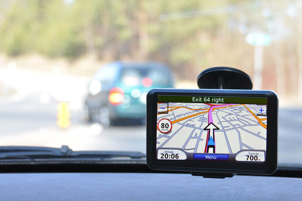
Modern vehicle navigation relies heavily on GPS technology, making everyday driving safer and more convenient. With the rise of smartphones featuring integrated GPS, car navigation has gained widespread popularity, though it often depends on internet connectivity. These systems incorporate various features that enhance the driving experience, from real-time traffic updates to route optimization. This overview explains the core components of these systems in simple terms and highlights their capabilities in improving navigation and safety.
The main components of a GPS navigation system include:
The GPS antenna receives signals from satellites, determining the vehicle's location.
The direction sensor tracks the vehicle's heading.
The speed sensor measures how fast the vehicle is moving, helping estimate the remaining distance.
The display screen presents routing information visually.
Map data is cross-checked with satellite signals and sensor inputs to show accurate positioning on the screen.
The navigation unit processes all data, comparing it with a comprehensive map database to pinpoint the vehicle's exact location and estimate arrival time, considering current speed and distance.
Besides locating the vehicle, these systems perform route planning and continuously monitor real-time traffic conditions to avoid congestion and delays.
This is achieved through four key data sources:
Road network and connection information
Background geographic data, including rivers and contours
Site details such as building names and addresses
Traffic and incident reports from authorities and other drivers
Voice guidance functions determine the current location, set the destination, and identify optimal routes — the shortest and fastest options are recommended. Background geographic data helps provide accurate voice directions. The system displays route details and leverages real-time updates to inform drivers of traffic jams, ensuring smooth journeys and reduced travel stress.